Rocks and mud
Hiking Dolly Sods Wilderness, WV
For a change of scenery with all the training we’ve been doing, we decided to go to WV. We spent two days hiking in the Dolly Sods Wilderness and surrounding area.
Dolly Sods is well known for being muddy, but other areas of the trails are nothing but rocks. You really have to watch your step, or you will twist an ankle. Being that we are having a dry spring, we didn't encounter a lot of mud, though we could see the evidence of where the muddy areas are. We did hop from rock to rock across a stream or two and one part of the trail was a fairly dry creek bed.
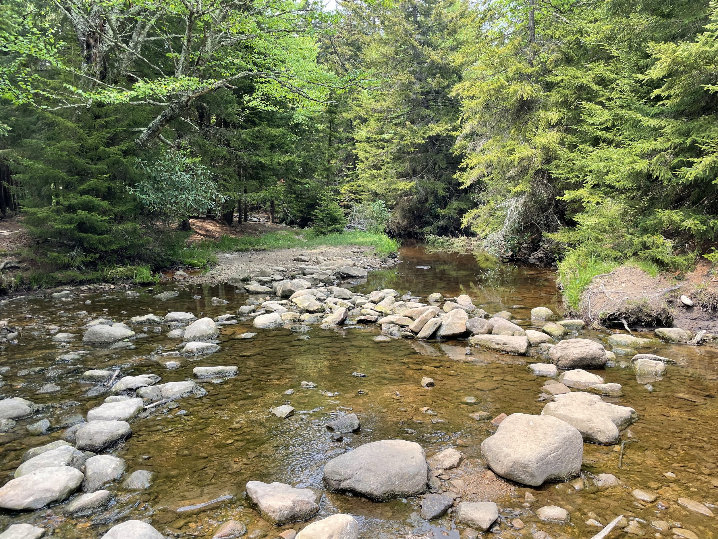
Creek Crossing
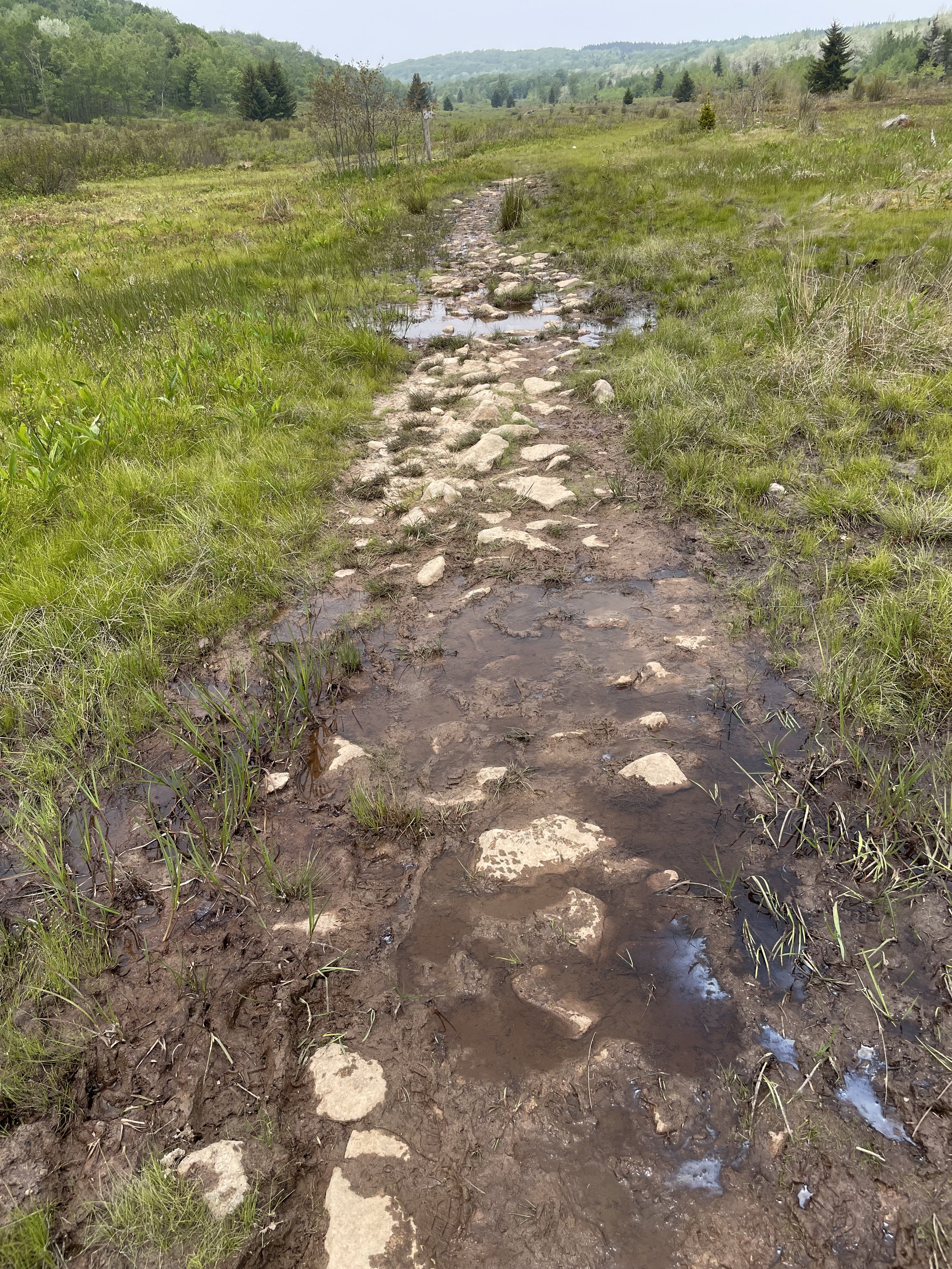
Muddy Trail
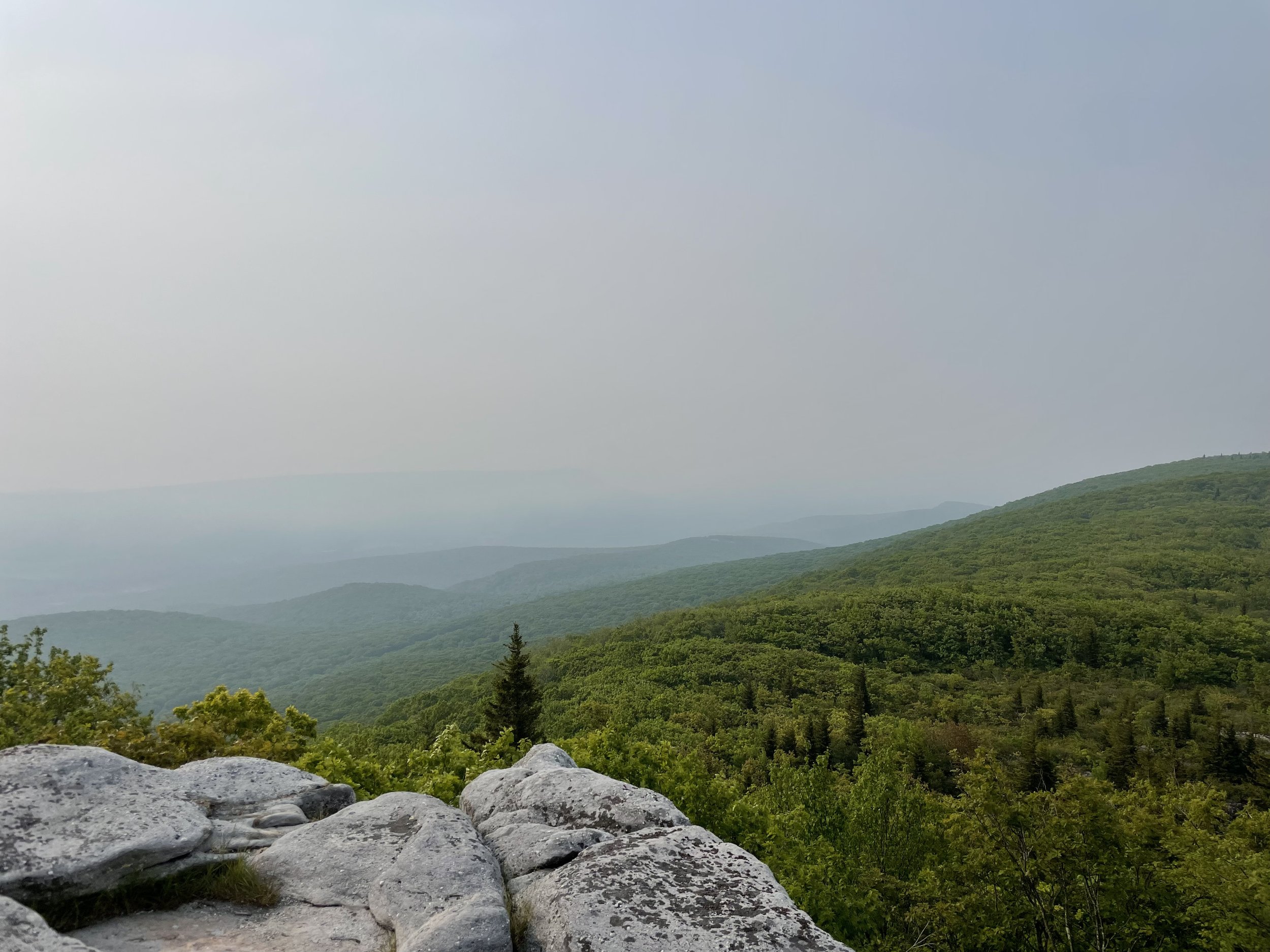
We started the first day by taking the short walk from the parking lot to Bear Rocks. Thankfully it is a short walk, as we felt like we needed to be mountain goats to walk over the stones leading to the rocks themselves. It was a nice view from the top, though a little hazy (possibly from the Canadian wildfires).

Trail to Bear Rocks
View from Bear Rocks
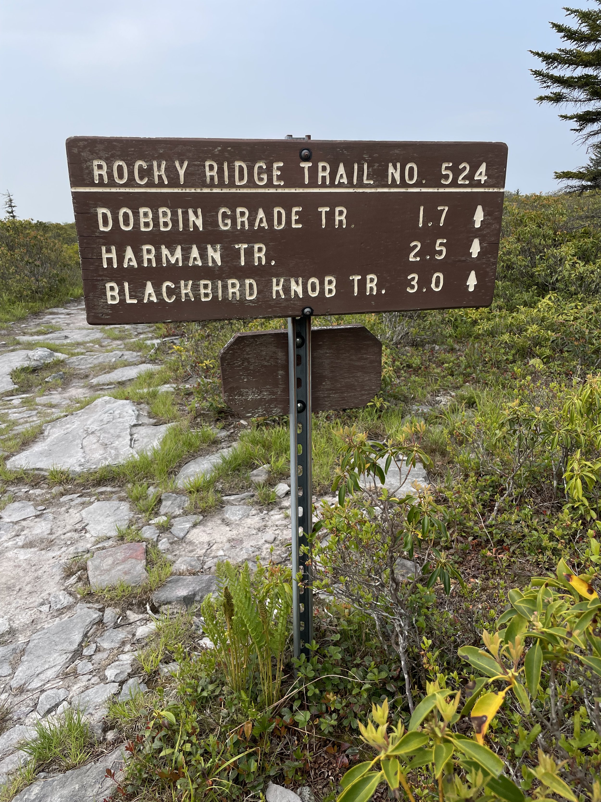
We then headed down trail 522 - Bear rocks trail. The trails all have names and numbers. The trail map uses numbers and the signs usually use both. The map is well done and the trails are easy to follow. None of the trails had blazes, but every intersection was clearly marked with a directional sign.

Trail map
Trail sign
We only wondered off the trail twice. The first time was when scrambling over rocks and lost sight of the trail and the second was when we had to blaze our own route around the beaver dam. Yes, a beaver decided to build his dam right along the trail and completely flooded it. We saw several beaver dams and lots of areas where they had clear cut for wood, but we never actually saw any beavers. The only wildlife we saw was one fawn that we must have startled from where he was sleeping.
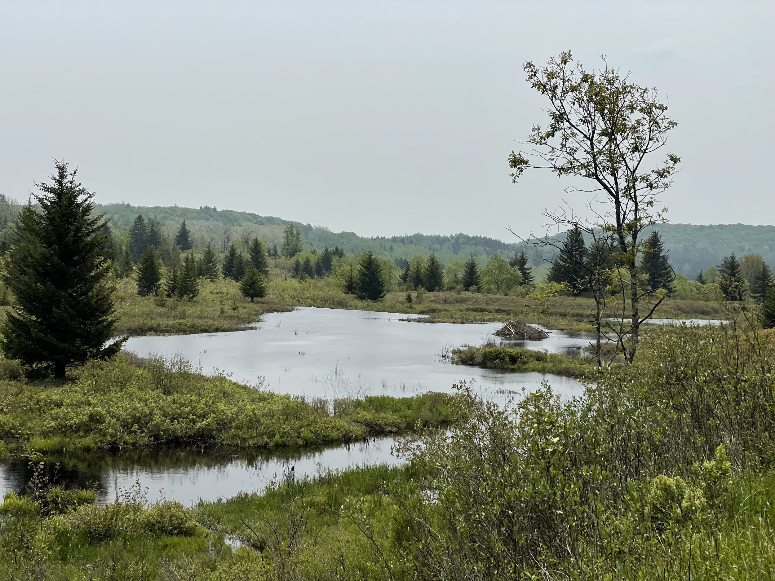
Beaver dam
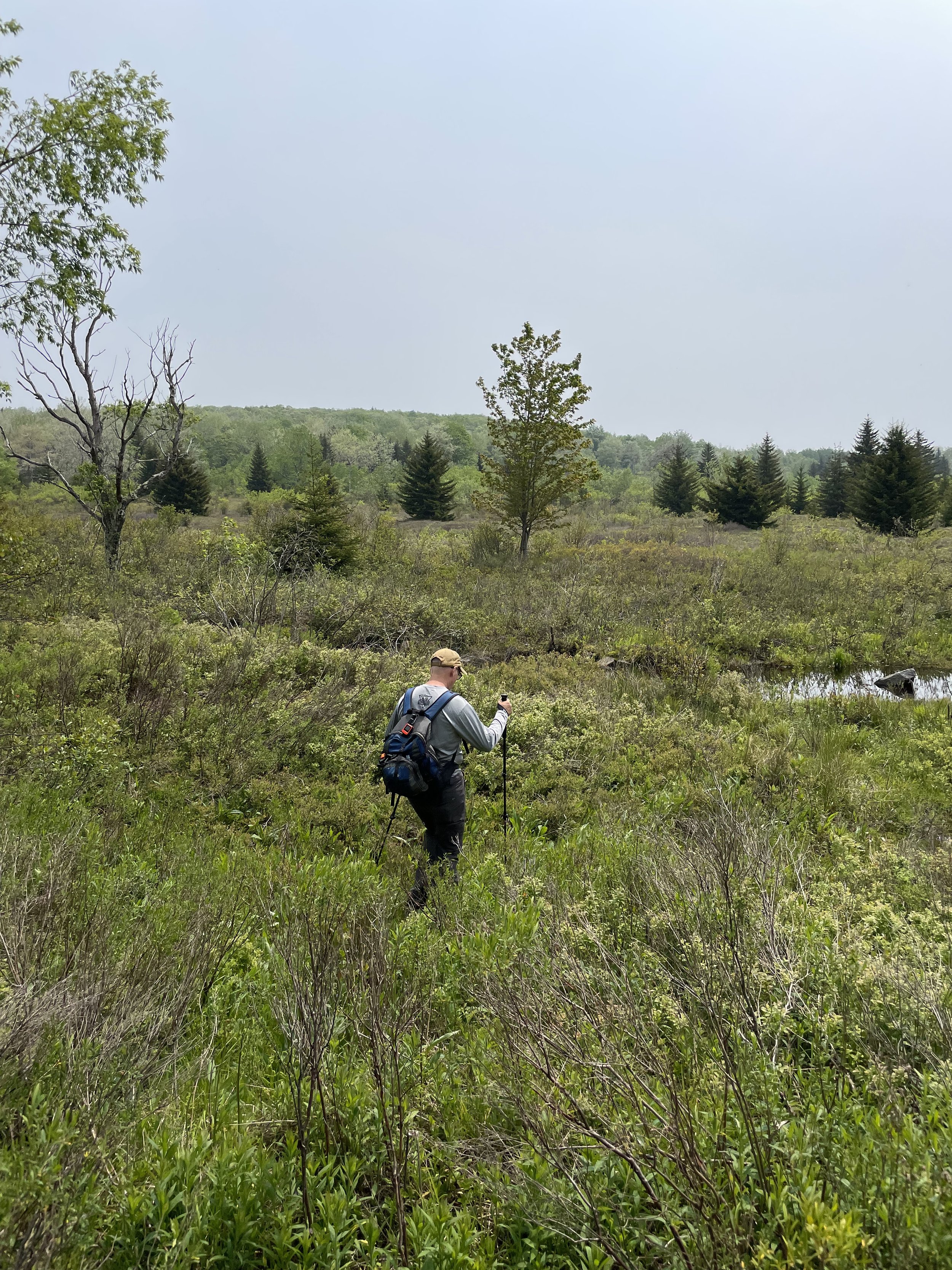
Steve making a trail around beaver dam
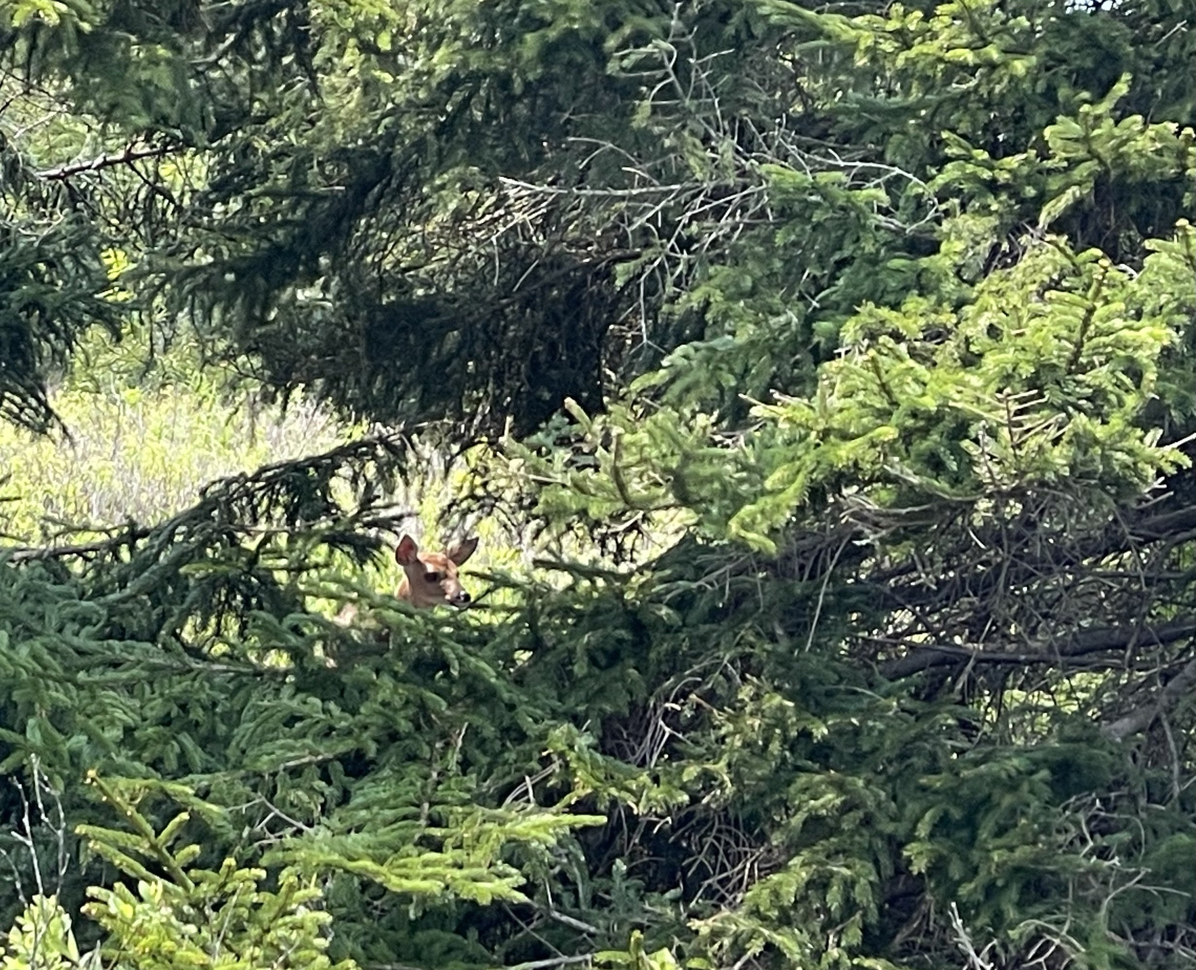
Fawn hiding in the trees
One item of interest we found was a credit card. We picked it up in hopes of finding the owner. A short time later we came across four WVU students and the card did belong to one of them. We were able to return the card to a very grateful owner.
Day one complete with about 14 miles covered.
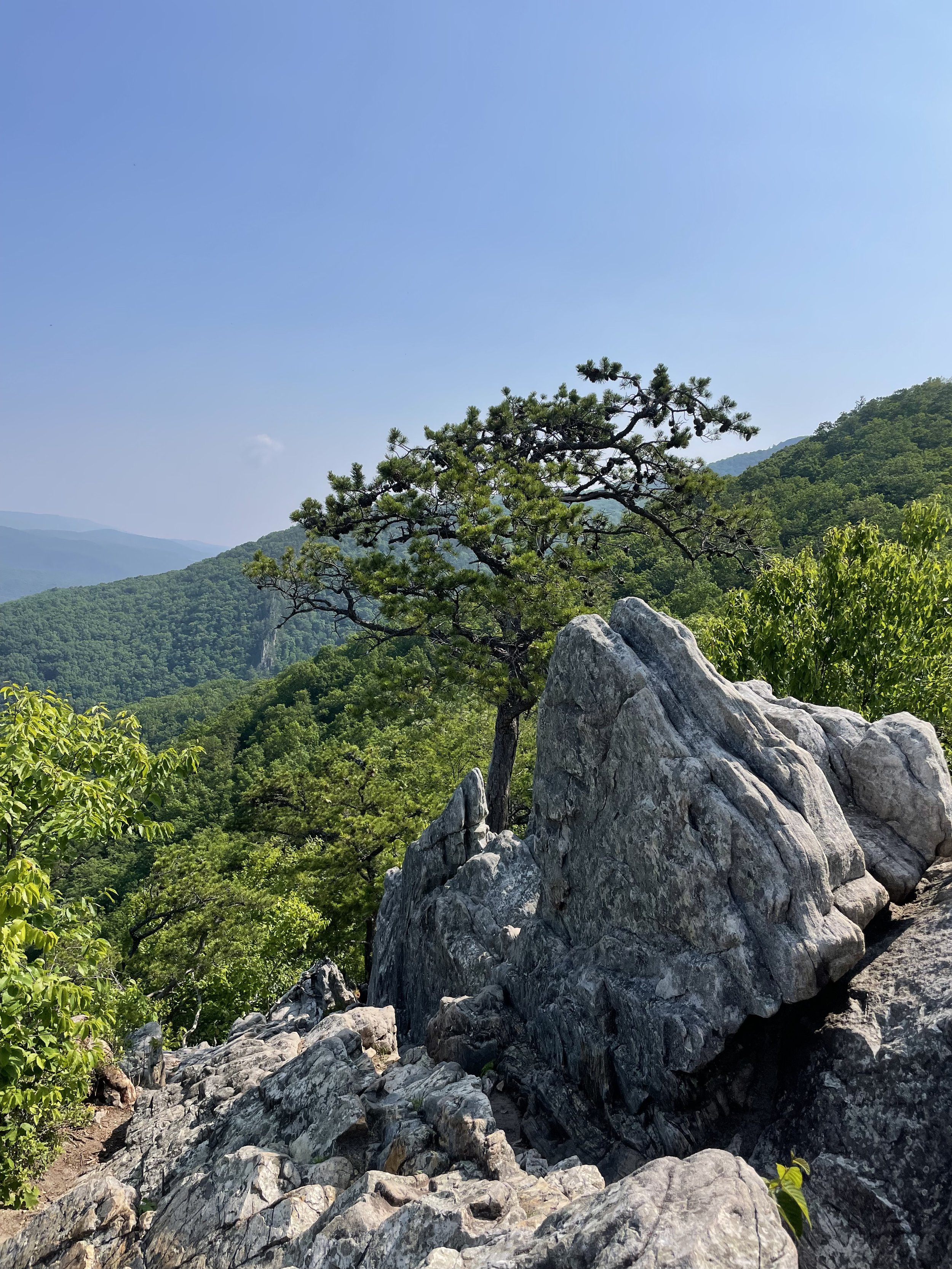
Before returning to Dolly Sods on day two, we first went to Seneca Rocks, a formation rising about 900 feet above the North Fork River. A 1.3 mile trail leads up 700 feet in elevation to an observation platform. While the view from the platform is beautiful, you really can’t see the rock formation from it. Just past the platform is the rocks, with a warning sign about climbing onto the rocks at your own risk. We of course climbed on to the rocks. The view from the rocks is spectacular.
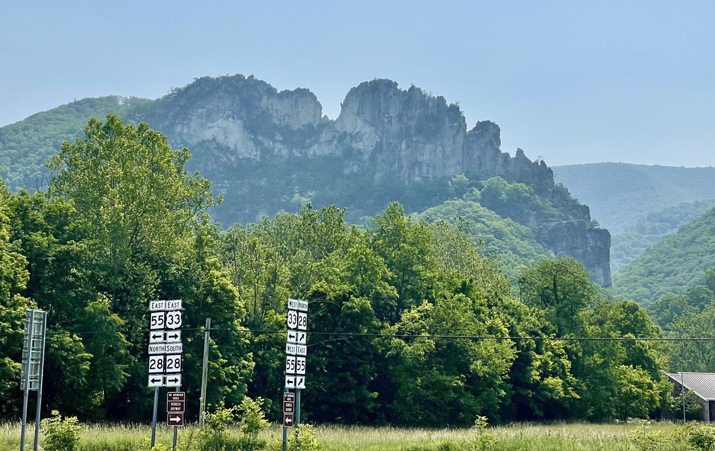
Seneca Rocks

Steve on Seneca Rocks
View from Seneca Rocks
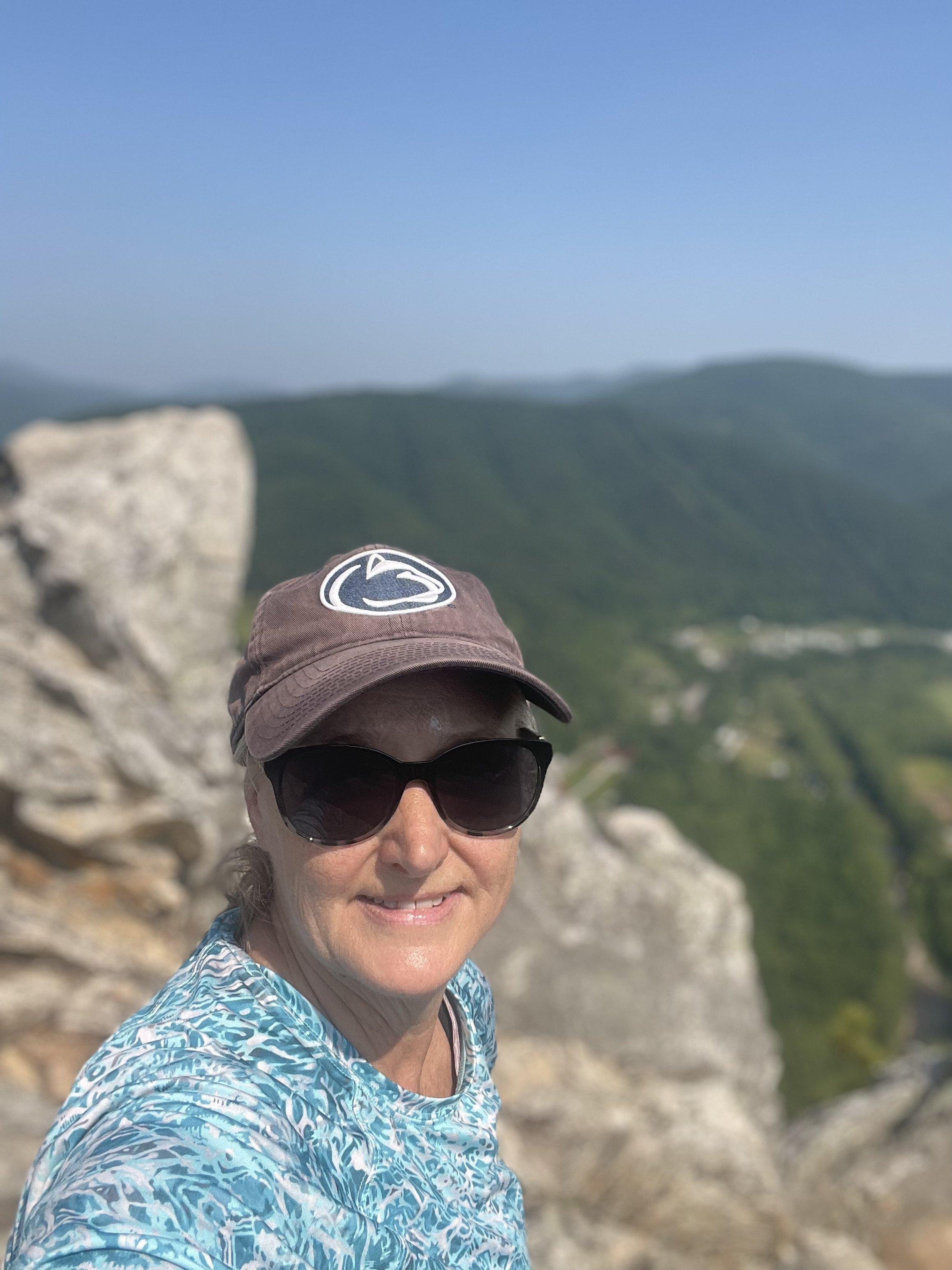
Brenda on Seneca Rocks
Back down at ground level, we hiked some more in Dolly Sods in a different area of the wilderness. Making a loop, we hiked trails 511 (Blackbird Knob), 514 (Red Creek), and 553 (Breathed Mountain). Again the trails were easy to follow winding down and up the mountain side. And of course there were lots of rocks and some wet areas. We covered about 9 miles on this loop.
It was a great 2 days of hiking and many miles added to our training.